Comprehending London through its maps

More than any other city in the world, London is a metropolis defined by its maps. There is no better example of this than two iconic works: Harry Beck's famous diagrammatic map of the London Underground and the indispensable London A-Z Guide. With one a simplified presentation of the routes of London's light rail system and the other an effort to chart in detail the myriad roads of the city the two could not be more dissimilar, yet they are both depictions of the same geographic place designed to help people better access them.
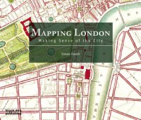
Such comparisons are at the heart of Simon Foxell's book. In it he examines the ways in which people have represented London over the centuries by showing the various maps created for that purpose. He divides his presentation into categories, demonstrating how people drafted maps to understand all sorts of details about the city, from its geographic pathways to the everyday lives people led. While some of these maps detailed the range and vagaries of life in the city, others defined boundaries designed to make the city governable. Foxell supplements these maps with both descriptive captions and a text explaining the history of such efforts. From them emerges an appreciation of how maps helped Londoners to understand the city in which they lived, which they often did through a process of sectioning, graphing, and labeling that helped them to process the mass of details about their city into a medium that helped them to better comprehend their often chaotic environment.
While Foxell's written explanations provide a helpful context for interpreting the maps he analyzes, it is the reproduction of the maps themselves which best make his points, and which make his book such a pleasure to read. Together the combination provides an engaging description of the history of mapping London and what those maps reveal about the evolution of the city, one that appeals both to fans of the city and students of cartography.
 3
3


